 KiwiScience
Tika Tipu is experimental. It is a plant selector for students, researchers and curious minds. There is no guarantee that its outputs are entirely accurate — always sanity-check a species list against local knowledge, your regional council, and an eco-sourcing nursery before you buy plants.
Tika Tipu 是一个试验性工具。它是面向学生、研究者和好奇者的植物选择器,不保证输出结果完全准确——在买苗之前,请务必对照本地知识、所在大区议会的建议,以及本地采种苗圃的意见,核验物种清单是否合理。
Part 1 · User guide第一部分 · 使用指南
Using Tika Tipu使用 Tika Tipu
Tika Tipu — the right plant in the right place — narrows a database of New Zealand plants down to the ones that suit your particular patch of ground. You answer up to five questions about the site, and the app returns the species that match all of them. It starts with native species only; a second database of exotic plants — crops, pasture, forestry and ornamentals — can be switched on at any point.
Tika Tipu — 把合适的植物种在合适的地方 — 会把一个新西兰植物数据库,逐步收窄到适合你那一小块地的物种。你最多回答五个关于样地的问题,应用就会返回同时满足这些条件的物种。默认只检索原生物种;另一个外来植物数据库——作物、牧草、林木与观赏植物——可以随时开启。
1 How the selector works选择器的工作方式
Every filter you set narrows the list. Every filter you skip widens it. The counter at the top of the app — n species match — updates live, so you can watch the effect of each choice as you make it.
每设定一个筛选条件,清单就收窄一分;每跳过一个条件,清单就放宽一分。应用顶部的计数器——n 个物种符合——会实时更新,你可以一边选择一边看到每一步的效果。
All five filters are optional. Skipping one means “any”, not “none”. If you only know your region, set the region and jump straight to the results.
五个筛选条件全都是可选的。跳过某一项意味着"不限",而不是"没有"。如果你只知道自己的生态区,那就设定生态区,然后直接跳到结果。
Sitting above all five is the choice of which database to draw on — native species, exotic species, or both. It is not a step in the wizard because it applies to every step at once: natives, exotics, or both.
凌驾于这五项之上的,是检索哪个数据库的选择——原生物种、外来物种,还是两者。它不算向导中的一"步",因为它同时作用于每一步:原生、外来,还是两者。
| Step | What it asks | Skip it if… |
|---|---|---|
| 步骤 | 它在问什么 | 什么时候可以跳过 |
| 1 · Region | Which ecological region your site sits in | You want the national list, or your site is a garden using cultivated stock |
| 1 · 生态区 | 你的样地位于哪个生态区 | 你想要全国清单,或者样地是使用栽培苗木的花园 |
| 2 · Soil | The soil order under your site | You have not looked the soil up yet |
| 2 · 土壤 | 样地下面是哪个土纲 | 你还没有查过土壤类型 |
| 3 · Moisture | How wet the ground usually is, and whether it can suffer droughts | Conditions vary a lot across the site |
| 3 · 水分 | 地面平常有多湿,以及会不会遭遇干旱 | 样地内部条件差异很大 |
| 4 · Frost | The worst frost the site normally gets | You do not know the site’s winters yet |
| 4 · 霜冻 | 样地通常会遇到的最重霜冻 | 你还不了解样地的冬季情况 |
| 5 · Plant use | The setting and the exact zone within it | You want a general regional list rather than one tuned to a niche |
| 5 · 种植用途 | 种植的场景,以及场景内具体的位置分区 | 你想要一份泛用的区域清单,而不是针对某个小生境的精细清单 |
| 6 · Results | — | — |
| 6 · 结果 | — | — |
Move around freely. The numbered stepper at the top of the app is clickable — you can jump back to any step, change one answer and return to the results. The chips in the sticky bar show what is currently set, and the small × on each chip clears just that filter.
可以随意来回切换。应用顶部带编号的步骤条是可点击的——你可以跳回任意一步,改动一个答案,再回到结果页。吸顶栏里的标签显示当前已设定的条件,标签上的小 × 只清除那一项筛选。
↻ Start over in the header clears everything at once.
页首的 ↻ 重新开始 会一次性清空所有条件。
2 Natives, exotics, or both原生、外来,还是两者
Tika Tipu draws on two databases. The native one is Dr Colin Meurk’s: 1,018 species indigenous to Aotearoa, and the work the tool was built around. The exotic one is a companion of 527 introduced species grown, planted or naturalised here — pasture and forage plants, arable and horticultural crops, exotic forestry and eucalypts, shelterbelt and hedging species, poplars and willows grown for soil conservation, ornamental trees and shrubs, herbaceous perennials, bulbs, groundcovers, climbers and aquatics.
Tika Tipu 依托两个数据库。原生数据库来自 Colin Meurk 博士:收录 1,018 种新西兰本土物种,也是本工具最初围绕建立的基础。外来数据库是它的配套,收录 527 种在新西兰栽培、种植或已归化的引入物种——牧草与饲用植物、大田与园艺作物、外来用材林与桉树、防风林与绿篱树种、用于水土保持的杨树和柳树、观赏乔灌木、草本宿根植物、球根植物、地被、藤本与水生植物。
The three buttons in the sticky bar at the top of the selector choose between them, and they apply to every step and every result:
选择器顶部吸顶栏里的三个按钮用于切换数据库,它们对每一步和每一条结果都生效:
| Button | What you get | Use it when |
|---|---|---|
| 按钮 | 得到什么 | 适用场合 |
| Natives only | The 1,018 native species, and nothing else. This is the starting state. | Restoration, revegetation, eco-sourcing, or any planting where the point is indigenous biodiversity |
| 仅原生植物 | 只有那 1,018 种原生物种,别无其他。这是默认状态。 | 生态修复、植被恢复、本地采种,以及任何以本土生物多样性为目的的种植 |
| Natives + exotics | All 1,544 species in one list. Exotics carry a small exotic mark on their card. | A shelterbelt, an amenity planting or a garden where the best answer might be either |
| 原生 + 外来 | 全部 1,544 个物种合为一份清单。外来物种的卡片上带一个小小的 外来 标记。 | 防风林、景观绿化或花园——最合适的答案可能来自任何一边 |
| Exotics only | The 526 exotic species on their own. | A vegetable bed, a pasture mix, a production forest — jobs no native does |
| 仅外来植物 | 单独列出那 526 个外来物种。 | 菜畦、牧草混播、用材林——这些活儿没有原生种能干 |
The region columns mean different things in the two databases. For a native, a region flag says the species occurs naturally there. For an exotic, it says the species can be grown there — a climate-and-site judgement, not a distribution record. Reading an exotic’s region list as a natural range would be wrong.
两个数据库中,"生态区"列的含义并不相同。对原生物种来说,某个生态区被标记,表示该物种在那里自然分布。对外来物种来说,它表示该物种在那里能够栽培——这是一项气候与立地的判断,不是分布记录。把外来物种的生态区列表当作天然分布范围来读,是错误的。
The two databases do not have the same standing. The native data is Colin’s, compiled over decades. The exotic data is derived: names, heights, spacings and the five tolerance ratings are compiled values, and the rest is worked out by rule from a curated trait record for each species, tested against a climate envelope for each ecological region. Treat an exotic list as a first approximation for screening, and check it against local knowledge and nursery advice before it drives a planting decision.
两个数据库的权威性并不相同。原生植物的数据出自 Colin 之手,历经数十年编纂。外来植物的数据则是推导而来的:名称、株高、株距和五项耐性评级是汇编数值,其余内容由每个物种经整理的性状记录按规则推算,并与各生态区的气候包络逐一比对检验。请把外来物种清单当作初筛用的一级近似,在它左右你的种植决策之前,先对照本地经验和苗圃意见加以核验。
Nothing in the exotic database is banned from sale. Species on the National Pest Plant Accord, and well-known regional pest plants, were left out — no wilding conifers, no grey and crack willow, no sycamore, no hawthorn, gorse, broom, ivy, privet, barberry or pampas. The Accord is amended from time to time, so check the current list and your regional pest management plan before you plant anything from it.
外来植物数据库中没有任何一种是被禁止销售的。列入 National Pest Plant Accord 的物种以及各地公认的有害植物都已剔除——不含野化针叶树,不含灰柳和爆竹柳,不含欧亚槭、山楂、荆豆、金雀花、常春藤、女贞、小檗或蒲苇。该协定会不时修订,因此在种植其中任何一种之前,请查阅最新名录和你所在大区的有害生物管理计划。
If a search comes back empty with natives only, the results page will tell you how many species the same search would find with the exotic database included, and offer a button to switch it on. That happens a lot on the five productive-land settings below: no native belongs in a raised vegetable bed.
如果只检索原生物种时返回空结果,结果页会告诉你:同样的条件在纳入外来植物数据库后能找到多少个物种,并提供一个按钮直接切换过去。在下文那五个生产用地场景中,这种情况很常见:高畦菜地里本来就没有原生种的位置。
3 Step 1 · Ecological region第 1 步 · 生态区
Many native species in Aotearoa occur naturally only in certain parts of the country. Manawa, the New Zealand mangrove (Avicennia marina), grows only north of Kawhia and will not survive further south. Filtering by region is the single most effective way to avoid recommending a plant that has no business being on your site.
新西兰的许多原生物种只天然分布于国内特定的区域。manawa,即新西兰红树(Avicennia marina),只生长在 Kawhia 以北,再往南就活不下来。按生态区筛选,是避免推荐一株根本不该出现在你样地上的植物的最有效办法。
New Zealand is divided into 78 ecological regions, which group ecological districts sharing broadly similar geology, climate, landforms and biota. In the app you can either click your site on the map or pick a region from the dropdown list.
新西兰划分为 78 个生态区,每个生态区由地质、气候、地貌与生物区系大体相似的若干生态小区组成。在应用里,你可以在地图上点击你的样地,也可以从下拉列表中选择生态区。
One click answers three steps. Clicking the map does not only choose the region. It also reads the soil order and the frost at that exact point off the national soil and climate maps, and fills in step 2 and step 4 for you. A green panel under the map says what it found. Both answers are ordinary filter settings: change either at its own step, or clear it from the chips at the top of the page. Picking a region from the dropdown instead leaves soil and frost alone — a region is not a point, and the maps can only be read at a point.
点击一次,答完三步。在地图上点击不只是选定生态区。它还会从全国土壤图和气候图上读取那一点的土纲与霜冻情况,替你填好第 2 步和第 4 步。地图下方的绿色面板会说明读到了什么。这两个答案都只是普通的筛选设定:可以在各自那一步里改动,也可以在页面顶部的标签上清除。若改用下拉列表选择生态区,土壤和霜冻则不会被填写——生态区是一个面,不是一个点,而图层只能在点上读取。
- Not sure which region you are in? Zoom the map to your site — the region boundaries are drawn over the basemap and the name appears when you click.
- Working across a boundary? Run the search twice, once for each region, and plant only the species that appear in both lists.
- Eco-sourcing: region is also your guide to provenance. Seed collected from your own ecological region is better adapted to local conditions and keeps regional genetic character intact.
- 不确定自己属于哪个生态区?把地图放大到你的样地——生态区界线绘制在底图之上,点击后会显示名称。
- 样地跨越了分界线?把检索做两遍,每个生态区各做一次,只种在两份清单里都出现的物种。
- 本地采种(eco-sourcing):生态区也是种源的指引。采自你所在生态区的种子更适应当地条件,也能保持该区域的遗传特征不被稀释。
Read more:延伸阅读: DOC guide to ecological regions and districts (PDF)DOC 生态区与生态小区指南(PDF,英文) · Wikipedia overview维基百科概述(英文)
4 Step 2 · Soil order第 2 步 · 土纲
Most plants are adapted to particular soil environments. The New Zealand Soil Classification sorts our soils into 15 orders on the basis of how they formed and how they behave; Tika Tipu uses 14 of them — all but Anthropic, the made ground of fills, quarries and town sections, which is not a thing to choose a plant palette from. If you clicked your site on the map at step 1 this step is already answered; otherwise look your site up on the Landcare Research soil map before you choose.
大多数植物都适应特定的土壤环境。新西兰土壤分类按成土过程与性状,把全国土壤分为 15 个土纲;Tika Tipu 用到其中 14 个——唯独不含 Anthropic(人为土),即填方、采石场和城镇地块上的人造地面,那不是用来挑选植物配置的依据。如果你已在第 1 步点过地图,这一步就已经填好了;否则请先在 Landcare Research 土壤图上查一下你的样地再选。
What the map reads. The soil order comes from the national soil map at 100 m resolution, so it answers for a hectare, not for a garden bed. Nineteen twentieths of the country carries a mapped soil order. The rest is town, lake, river bed, estuary, ice or made ground, and the map has no soil order for it — which includes the middle of most cities. For those points Tika Tipu offers the commonest soil order mapped within about 5 km and says so plainly. Where even that is empty — a lake, an icefield, the middle of Auckland — you get no answer instead of a guess. Treat a “nearby” answer as the soil of the district, and dig a hole before you trust it.
地图读取的是什么。土纲来自分辨率 100 米的全国土壤图,所以它回答的是一公顷范围的情况,而不是一畦菜地。全国约二十分之十九的面积有已制图的土纲,其余是城镇、湖泊、河床、河口、冰川或人造地面,图上没有土纲——这也包括大多数城市的中心区。对这些点位,Tika Tipu 会给出约 5 公里范围内制图最普遍的土纲,并明确说明这一点。若连这也没有——湖面、冰原、奥克兰市中心——它宁可不给答案,也不猜。对"附近取值"的答案,应当理解为本地区的土壤,动手挖个坑之后再去相信它。
| Soil order | What it is like |
|---|---|
| 土纲 | 大致性状 |
| Pallic | Pale soils; wet in winter, dry in summer. Dry eastern hill and downlands. |
| Pallic | 颜色浅淡的土壤;冬湿夏干。分布于东部干燥的丘陵与波状高地。 |
| Brown | New Zealand’s most widespread soils; well drained, moderately fertile. |
| Brown | 新西兰分布最广的土壤;排水良好,肥力中等。 |
| Podzol | Acidic and strongly leached, under high rainfall and old forest. |
| Podzol | 酸性、强烈淋溶,见于高降水量地区和古老森林之下。 |
| Oxidic | Old, deeply weathered volcanic clays — Auckland and Northland. |
| Oxidic | 古老、深度风化的火山黏土——奥克兰与北地。 |
| Granular | Clayey soils formed on old volcanic ash. |
| Granular | 发育于古老火山灰上的黏质土壤。 |
| Ultic | Strongly weathered with a dense, clay-rich subsoil; prone to erosion. |
| Ultic | 强烈风化,心土致密富黏;易发生侵蚀。 |
| Raw | Very young and barely developed: screes, active dunes, tidal flats. |
| Raw | 非常年轻、几乎未发育:岩屑坡、活动沙丘、潮滩。 |
| Recent | Young soils on floodplains, slopes and fresh alluvium; often fertile. |
| Recent | 发育于泛滥平原、坡地和新鲜冲积物上的年轻土壤;往往较肥沃。 |
| Melanic | Dark, well-structured and fertile; limestone and basalt country. |
| Melanic | 颜色深暗、结构良好、肥沃;见于石灰岩与玄武岩地区。 |
| Allophanic | Free-draining volcanic ash soils — Taranaki, Waikato, Bay of Plenty. |
| Allophanic | 排水通畅的火山灰土——塔拉纳基、怀卡托、丰盛湾。 |
| Pumice | Coarse, free-draining pumice of the central North Island. |
| Pumice | 北岛中部粗粒、排水通畅的浮石质土壤。 |
| Organic | Peaty soils of wetlands and bogs, formed from partly decayed plants. |
| Organic | 湿地与沼泽中的泥炭土,由部分分解的植物残体形成。 |
| Gley | Waterlogged soils with grey, oxygen-poor subsoils. |
| Gley | 长期渍水、心土呈灰色缺氧的土壤。 |
| Semi-Arid | The driest inland basins of Central Otago. Note the national soil map stops the Semiarid order at about Omarama, so a click in the Mackenzie returns Brown or Recent, not this. |
| Semi-Arid | 中奥塔哥最干旱的内陆盆地。请注意,全国土壤图把 Semiarid 土纲的范围止于 Omarama 一带,因此在 Mackenzie 盆地点击,返回的是 Brown 或 Recent,而不是本土纲。 |
Soil order and moisture are not the same question. A Gley soil is wet by definition, but a Brown soil might be wet in a hollow and dry on a ridge. Set the moisture step from what you can see on the ground, not from the soil name.
土纲和水分不是同一个问题。Gley 土按定义就是湿的,但同一个 Brown 土,在洼地里可能是湿的、在山脊上可能是干的。水分那一步要按你在地面上看到的情况来设定,而不是按土壤名称。
Read more:延伸阅读: NZ Soil Classification — the soil orders新西兰土壤分类——土纲(英文)
5 Step 3 · Soil moisture and drought第 3 步 · 土壤水分与干旱
Soil moisture describes the usual moisture content of the ground at your planting spot, for most of the year — not the state it happens to be in on the day you visit.
土壤水分指的是种植点的土壤在一年中大部分时间里的通常含水状况——而不是你去踏勘那天碰巧看到的状态。
| Setting | What it means | Typical places |
|---|---|---|
| 选项 | 含义 | 典型地点 |
| Wet | Waterlogged or frequently saturated | Swamp and bog margins, seepages, pond edges, backswamps |
| 湿润 | 长期渍水或经常饱和 | 沼泽与泥炭沼边缘、渗水面、池塘岸边、河后洼地 |
| Mesic | Moderate and well drained — neither soggy nor droughty | Most flat to rolling country, gentle slopes, sheltered gullies |
| 中湿 | 水分适中、排水良好——既不泥泞也不易旱 | 大多数平坦至波状地形、缓坡、背风冲沟 |
| Dry | Free-draining or drought-prone | Ridges, north-facing slopes, sand, gravel, shallow soils over rock |
| 干燥 | 排水通畅或易受干旱影响 | 山脊、朝北坡面、沙地、砾石地、岩石之上的薄层土 |
Sites are rarely uniform. A stream bank runs from wet at the water’s edge to dry on the terrace above in a few metres. Run a separate search for each moisture band and plant each band with its own list — that is exactly the thinking behind the zoned diagrams in Step 5.
样地很少是均质的。一处溪岸,从水边的湿到上方阶地的干,可能只相隔几米。为每一个水分带分别做一次检索,各按各自的清单来种——第 5 步里的分区示意图,正是这个思路。
Can the site suffer droughts?这块地会遭遇干旱吗?
The moisture band describes the usual state of the ground. Drought is a different question, and the tick box under the cards asks it separately: can this area go through spells where it dries out hard?
水分带描述的是土壤的通常状态。干旱是另一个问题,卡片下方的复选框单独问它:这块地会不会经历严重干透的时段?
It is not only dry sites that do. A mesic paddock on the east coast can bake through a dry summer; a wetland margin can draw down and crack in a drought year; a shallow soil over rock dries out within weeks of the last rain no matter how wet the district is. A species with no drought tolerance at all is the first thing to die in that spell, even though it looked perfectly matched to the site the rest of the time.
会遭遇干旱的并不只有干旱样地。东海岸一块中生的草场,可能整个干燥的夏天都被烤着;湿地边缘在干旱年份可能水位下降、地面开裂;岩石上的薄层土,无论所在地区多湿润,末次降雨后几周内就会干透。完全不耐旱的物种,正是在那段时间里最先死去的——哪怕它在其余时间看上去与样地完美匹配。
What ticking it does. The filter keeps only species carrying some drought tolerance, on top of whichever moisture band you chose. So “Mesic + droughts” gives you plants that like ordinary ground but will ride out a dry spell — a smaller and more resilient list than Mesic alone.
勾选之后会发生什么。在你所选水分带的基础上,筛选器只保留具备一定耐旱能力的物种。因此“中湿 + 易旱”给出的,是那些喜欢普通土壤、但能熬过一段旱情的植物——清单比单选 Mesic 更短,也更耐折腾。
6 Step 4 · Frost第 4 步 · 霜冻
Frost kills more new plantings than almost anything except stock and weeds, and it does it in the first winter. Many of our best-known natives — pōhutukawa, pūriri, karaka, nikau, kauri, mangrove — are frost tender and simply cannot be planted where the ground freezes. This step keeps them out of your list before you order them.
除了牲畜和杂草,霜冻杀死的新栽苗木比任何其他因素都多,而且往往就在头一个冬天。许多最负盛名的新西兰原生树——pōhutukawa、pūriri、karaka、nikau、kauri、红树——都不耐霜,在土壤会冻结的地方根本种不活。这一步会在你下单之前,就把它们从清单里剔除。
| Setting | What it means | Typical places |
|---|---|---|
| 选项 | 含义 | 典型地点 |
| Not sure | Skips the filter entirely | Use this if you do not yet know the site’s winters |
| 不确定 | 完全跳过这项筛选 | 还不了解样地冬季情况时选这个 |
| Frost-free | Frosts essentially never happen | Northland, coastal Auckland and Coromandel, exposed coastal edges anywhere warm |
| 无霜 | 基本不出现霜冻 | 北地、奥克兰与科罗曼德沿海,以及任何温暖地区的临海地带 |
| Light frosts | Occasional light ground frost, roughly to −2 °C | Most coastal and lowland districts, sheltered north-facing slopes |
| 轻霜 | 偶有轻度地面霜,约至 −2 °C | 大多数沿海与低地地区、背风的朝北坡 |
| Hard frosts | Regular or severe frosts | Inland and upland country, the Volcanic Plateau, inland Canterbury and Otago, frost hollows anywhere |
| 重霜 | 经常性或严重的霜冻 | 内陆与高地、火山高原、坎特伯雷与奥塔哥内陆,以及任何地方的霜穴地形 |
Answer for the worst frost your site normally sees, not the average. Choosing “Frost-free” excludes nothing — every plant copes with no frost — but it is still worth setting, because it records the answer on your results page.
要按你的样地通常会遇到的最严重的霜来回答,而不是平均水平。选“无霜”不会排除任何物种——没有霜,什么植物都受得了——但仍然值得设定,因为它会把这个答案记录在结果页上。
What the map reads. Clicking your site at step 1 answers this step from NIWA’s climate maps, and the panel under the map tells you the number it used: the average count of air frosts a year — days the temperature at screen height, about 1.3 m, drops below 0 °C. Fewer than one a year is read as frost-free, one to fifteen as light frosts, fifteen or more as hard. Those cuts put Northland, coastal Auckland, Tauranga, New Plymouth, Wellington and Kaikōura in the first box; Napier, Palmerston North, Hamilton, Hōkitika and Stratford in the second; and Rotorua, Christchurch, Blenheim, Nelson, Dunedin, Invercargill, Taupō, Ohakune, Timaru, Alexandra and Gore in the third.
地图读取的是什么。在第 1 步点击样地,这一步就会依据 NIWA 的气候图自动作答;地图下方的面板会告诉你它所用的数值:每年空气霜的平均日数——即百叶箱高度(约 1.3 米)气温降到 0 °C 以下的天数。每年不足一天读作无霜,一至十五天读作轻霜,十五天及以上读作重霜。按这个界限,北地、奥克兰沿海、陶朗加、新普利茅斯、惠灵顿和凯库拉属于第一档;内皮尔、北帕默斯顿、汉密尔顿、霍基蒂卡和斯特拉特福属于第二档;罗托鲁瓦、基督城、布莱尼姆、尼尔森、但尼丁、因弗卡吉尔、陶波、奥哈库尼、蒂马鲁、亚历山德拉和戈尔属于第三档。
Fifteen rather than a rounder twenty-five because ground frost is far more common than air frost — the grass freezes on nights the thermometer stays above zero. Christchurch averages eighteen air frosts a year but eighty-five ground frosts, and a mean July minimum of 0.7 °C; Nelson seventy-five, Invercargill sixty-seven. None of those is “occasional light frost”, whatever the air-frost count says. The other thing the number does not know is your hollow: the climate grid is 5 km, far coarser than the ground that actually collects cold air. Both errors run the same way, so if the map and your own winters disagree, believe your winters.
界限取十五而不是更整齐的二十五,是因为地面霜远比空气霜常见——温度计始终在零度以上的夜晚,草面照样结冰。基督城平均每年有十八个空气霜日,地面霜日却有八十五个,七月最低气温均值为 0.7 °C;尼尔森是七十五个,因弗卡吉尔是六十七个。无论空气霜日数怎么说,这些都算不上"偶有轻霜"。这个数字还有一件事不知道,那就是你那个洼地:气候网格是 5 公里,远比真正会积聚冷空气的地形尺度粗糙。两种误差的方向一致,所以若地图与你亲身经历的冬天相左,请相信你的冬天。
Cold air runs downhill and pools. A valley floor, a hollow, or flat ground trapped behind a solid fence or shelterbelt can frost several degrees harder than the slope immediately above it. Frost hollows are why a species that thrives on the hillside dies on the flat below. If your site is one of those, answer for the hollow, not for the district.
冷空气会顺坡下沉并积聚。谷底、洼地,或被实心围栏、防风林挡住的平地,霜情可能比紧邻其上的坡面重上好几度。霜穴地形正是"同一物种在山坡上长得好、在下面平地上却死掉"的原因。如果你的样地属于这种情形,请按洼地的情况回答,而不是按整个地区。
7 Step 5 · Plant use and zones第 5 步 · 种植用途与立地分区
This is the step that makes Tika Tipu more than a regional species list. Choose the setting you are planting — a road verge, a raingarden, a dune, a wetland — and the app draws that setting as a labelled cross-section. Then click the exact zone in the drawing where your plants are going.
正是这一步,让 Tika Tipu 不只是一份区域物种清单。选定你要种植的场景——路侧绿带、雨水花园、沙丘、湿地——应用就会把这个场景画成一张带标注的横断面图。然后在图上点击你要种植的那个具体分区。
Each zone carries its own palette of species. The crest of a dune, its seaward front slope and the damp slack behind it are three completely different growing environments only metres apart, and the app treats them that way.
每个分区都有自己的一套物种配置。沙丘的脊顶、朝海的前坡,以及其后潮湿的丘间低地,相隔不过几米,却是三种截然不同的生长环境——应用正是这样区别对待的。
- Pick a setting from the card grid. Each card shows a thumbnail of its cross-section.
- Click a zone in the drawing. Hover first — a label names each zone before you commit.
- Only one zone at a time can be active. Clicking the selected zone again clears it.
- Check the chips below the drawing. Some zones cannot be drawn in cross-section (a pergola, a rock garden, a swale’s dry bed) and are offered as chips instead. They work the same way.
- Use the back button above the drawing to return to the settings grid and try another.
- 从卡片网格中选定一个场景。每张卡片上都有该场景横断面的缩略图。
- 在图上点击一个分区。先把鼠标停上去——在你确定之前,标签会告诉你每个分区的名称。
- 同一时间只能激活一个分区。再次点击已选中的分区即可取消。
- 留意图下方的标签。有些分区无法画进横断面(凉棚、岩石园、植草沟的干燥沟底),因此改以标签形式提供,用法完全相同。
- 用图上方的返回按钮回到场景网格,换一个场景试试。
The drawings live in the app, not in this guide. They are interactive there — hover to read a zone name, click to select it. Open Step 5 in Tika Tipu to work through them.
这些图在应用里,不在本指南中。在应用里它们是可交互的——鼠标悬停可读分区名称,点击即可选中。打开 Tika Tipu 的第 5 步逐一试用。
The sixteen settings十六个场景
| Setting | What it covers | Examples of its zones |
|---|---|---|
| 场景 | 涵盖范围 | 分区举例 |
| Urban | Gardens, lawns, hedges, green roofs and walls | Living wall, green roof, herbaceous border, permeable paving, specimen tree, hedge |
| 城市 | 花园、草坪、绿篱、屋顶绿化与垂直绿化 | 垂直绿墙、绿色屋顶、草本花境、透水铺装、孤植树、绿篱 |
| Swales & Raingardens | Stormwater treatment and detention ponds | Road edge, wet bed, raingarden bed, wet and dry detention ponds, aquatic |
| 植草沟与雨水花园 | 雨洪净化与滞蓄塘 | 路缘、湿床、雨水花园种植床、湿式与干式滞留池、水生带 |
| Railway Ballast | Trackside and ballast planting | Inner ballast open turf, outer ballast edge turf, outermost shrubbery, outer rail back bush |
| 铁路道砟 | 铁路沿线与道砟种植 | 道砟内侧开阔草皮、道砟外缘草皮、最外侧道砟灌丛、外侧轨旁后方灌丛 |
| Road Verge | Verges and traffic islands | Water table, sight line, mown edge (low and mid), frangible edge, back fence, and cut/fill at crest, mid slope and foot |
| 路侧绿带 | 路肩绿带与交通岛 | 边沟、视距带、修剪边缘(低茬与中段)、易折边缘、后方围栏,以及坡顶、中坡和坡脚的挖方/填方 |
| Rural | Shelterbelts, farm planting and pasture | Two cross-sections. Shelter and road frontage: hedgerow, under pivot arm, 1–2 row shelterbelt, 3–5 row edge and centre, vineyard. Pasture and grazing: shade trees, dry hill, hay and silage, the grazed sward with its legume and herb components, laneway and stock camp, wet flats, grazed stream margin |
| 乡村 | 防风林、农场种植与牧草地 | 两幅横断面图。防护与临路种植:树篱、喷灌臂下、1–2 行防护林带、3–5 行防护林带的边缘与中央、葡萄园。牧场与放牧:遮荫树、干旱坡地、干草与青贮、放牧草地及其豆科和草本组分、牧道与牲畜歇息地、湿平地、河岸放牧边缘 |
| Riparian | Stream and river corridors | Terrace top, upper and lower scarp, levee, backswamp floodplain, emergent, aquatic bed |
| 河岸带 | 溪流与河流廊道 | 阶地顶面、上陡坎与下陡坎、天然堤、后沼漫滩、挺水带、水生河床 |
| Dune Country | Coastal dune systems | Two profiles: a sand dune (foredune toe, front slope, crest, back, slack, sand plain, interdune wetland, stable back dunes) and a rocky shore (coastal bush, cliffs, tidal pools) |
| 沙丘地 | 海岸沙丘系统 | 两幅剖面图:沙丘(前丘坡脚、迎海坡、丘顶、背坡、丘间低地、沙平原、丘间湿地、稳定的后丘)和岩石海岸(海岸原生林、悬崖、潮池) |
| Coastal | Estuaries, marshes and cliffs | Mudflats, lower and upper marsh, lagoon reeds, exposed cliffs, coastal bush edge and centre |
| 海岸 | 河口、盐沼与海崖 | 泥滩、低位与高位盐沼、潟湖芦苇、暴露悬崖、海岸原生林的边缘与中心 |
| Wetlands | Freshwater wetland types | Swamp, fen, grazing marsh, bog, aquatic floating and emergent, fluctuating tussock scrub and turf |
| 湿地 | 各类淡水湿地 | 沼泽、碱沼、放牧湿草地、酸沼、水生浮叶与挺水、水位波动的丛草灌丛与草皮 |
| Restoration | Bush and hillslope restoration | Skin, border and core rows; crest, upper, mid, foot and toe slopes; rolling hills, flats & plains; and the landform features drawn on the profile — rocky outcrop, slip edge and centre, seepage, moraine, montane, epiphytes |
| 生态修复 | 原生林与坡地修复 | 外皮、边界与核心各行;坡顶、上坡、中坡、坡麓与坡脚;起伏丘陵、平地与平原;以及剖面图上绘出的地形要素——岩石露头、滑坡边缘与中心、渗水地、冰碛、山地、附生植物 |
| Mātauranga Māori | Traditional uses and cultural plants | Rākau/muka, kai, rongoā, taonga, wai (water edge) |
| Mātauranga Māori(毛利传统知识) | 传统用途与文化植物 | Rākau/muka、kai、rongoā、taonga、wai(水边) |
| Remediation | Contaminated or degraded sites | Treated wastewater, mine spoil, quarry, compacted landfill |
| 污染治理 | 受污染或退化的场地 | 处理后的污水、矿山废土、采石场、压实的垃圾填埋场 |
| Vegetable Garden | A home food garden | Raised bed, open ground, bed edge and path, glasshouse or tunnel house, herb bed, trellis and climbing frame, perennial food bed, shelter hedge, pollinator and companion strip |
| 菜园 | 家庭食用作物园 | 高床、露地、床边与小径、温室或拱棚、香草床、棚架与攀爬架、多年生食用植物床、防护绿篱、传粉与伴生植物带 |
| Market Garden | Commercial cropping and arable | Cropping bed, wheel track and interrow, headland, insectary and beetle bank, cover crop and green manure, shelterbelt, tunnel house, drain and waterway margin |
| 商品菜园 | 商业种植与大田作物 | 种植床、轮辙与行间、地头、益虫带与甲虫堤、覆盖作物与绿肥、防护林带、拱棚、排水沟与水道边缘 |
| Flower Garden | Ornamental planting | Sunny and shady borders, bedding, cut-flower bed, bulb lawn and flowering meadow, cottage border, gravel and rockery, arch and climber, pond and bog edge, containers |
| 花园 | 观赏植物种植 | 向阳与背阴花境、花坛、切花床、球根草坪与开花草甸、村舍花境、砾石与假山床、拱门与攀援植物、池塘与沼泽边缘、容器 |
| Forestry | Production and permanent forest | Production stand, stand edge, riparian setback, road and landing, firebreak, erosion-control planting, understorey enrichment, boundary and amenity edge, nurse crop |
| 林业 | 用材林与永久林 | 生产林分、林缘、河岸退让带、林道与集材场、防火带、水土保持种植、林下补植、边界与景观边缘、护林作物 |
The last five settings were added with the exotic database — the four cards above plus pasture, which is the second drawing on the Rural card. A native-plant database had nowhere to put a cabbage, a ryegrass or a radiata pine, so these settings are mostly where the exotics live. Natives still appear in the parts of them a native belongs in: the shelter hedge round a vegetable garden, the insectary strip on a market garden, the riparian setback and the erosion-control planting in a forestry block, the grazed stream margin on a farm. Those native flags are derived from columns already in Colin’s database — the erosion-control, riparian, hedge and shade-tolerance columns — rather than being new judgements about native species.
最后五个场景是随外来植物数据库一并加入的——上面那四张卡片,再加上牧草地,即乡村卡片上的第二张图。一个只收原生植物的数据库,无处安放甘蓝、黑麦草或辐射松,所以这几个场景基本上是外来物种的地盘。原生物种仍会出现在它们该出现的位置:菜园四周的防护绿篱、商品菜园里的益虫带、林班中的河岸退让带与水土保持种植、农场上被放牧的溪流边缘。这些原生物种的标记,来自 Colin 数据库里已有的列——水土保持、河岸带、绿篱和耐荫性——而不是对原生物种作出的新判断。
Remediation settings are the most experimental part of the tool. Treat those lists as a starting point for further reading rather than a planting plan, and get specialist advice for contaminated ground.
污染治理场景是本工具中最具试验性的部分。请把那些清单当作进一步查阅资料的起点,而不是种植方案;受污染的土地务必咨询专业人士。
8 Step 6 · Reading your results第 6 步 · 解读结果
The results page lists every species that passes all of your filters, grouped by planting stage. The line under the heading restates the filters that produced the list, so a printed copy explains itself.
结果页按种植阶段分组,列出通过了全部筛选条件的每一个物种。标题下方那一行会重述生成该清单所用的筛选条件,因此打印出来的副本本身就能说明来历。
- Simple / Detailed switches the level of information. Simple gives names only; Detailed adds height, spacing, synonym, growth form, shade tolerance and ecosystem services for each species. Where the database has no value for something it says so rather than printing a zero.
- Refine these results narrows the list further without going back through the wizard: search by name or synonym, or filter on ecosystem service, growth form, planting stage, shade, wet ground, salt, and a height range.
- Species names search the New Zealand Plant Conservation Network for that plant — photographs, description, distribution and conservation status. It opens a search rather than going straight to the species page because this database keeps the names plants were published under, and NZPCN follows current taxonomy: Uncinia is now Carex, Hebe is now Veronica. The search matches the old name to the new one, so you land on the right plant either way. For a name recorded only to genus — Myosotis spp. — you get the genus.
- Copy list puts the names on your clipboard, ready to paste into an email to a nursery.
- Print produces a clean copy with the app furniture stripped out.
- 简要 / 详细 切换信息详略。“简要”只给名称;“详细”会为每个物种补充株高、株距、异名、生长型、耐荫性和生态系统服务。数据库中若无某项数值,它会如实说明,而不是打印一个零。
- 进一步筛选这些结果可以在不回到向导的情况下进一步收窄清单:按名称或异名搜索,或按生态系统服务、生长型、种植阶段、耐荫、耐湿、耐盐以及株高区间筛选。
- 点击物种名称会到 New Zealand Plant Conservation Network 搜索该植物——照片、描述、分布和受威胁状况。之所以打开搜索页而不是直接跳转到物种页面,是因为本数据库保留的是植物发表时所用的学名,而 NZPCN 采用当前分类:Uncinia 现已并入 Carex,Hebe 现已并入 Veronica。搜索会把旧名匹配到新名,所以无论哪种情况你都能找到正确的植物。若记录只到属一级——如 Myosotis spp.——得到的就是该属。
- 复制列表把名称复制到剪贴板,可直接粘进发给苗圃的邮件里。
- 打印生成一份去掉应用界面元素的干净副本。
No results? You have probably over-filtered. Clear the most restrictive chip first — usually the plant-use zone, then the soil order. A combination such as a Pumice soil in a Southland wetland may genuinely have no matches because it barely exists.
一个结果都没有?多半是筛得太狠了。先清除限制最强的那个标签——通常是种植用途分区,其次是土纲。像"Southland 的湿地上的 Pumice 土"这种组合,可能真的没有匹配结果,因为这种地方几乎不存在。
9 Planting stages种植阶段
Results are grouped by planting stage — the order in which species go into the ground on a restoration, not how big they get. Working through the stages is what turns a list of plants into a sequence of plantings, often over several years.
结果按种植阶段分组——指的是生态修复中各物种下地的先后顺序,而不是它们长多大。按阶段推进,才能把一份植物清单变成一套往往要跨越数年的种植时序。
| Stage | What goes in | When |
|---|---|---|
| 阶段 | 种什么 | 什么时候种 |
| 1 · Pioneers & colonisers | Hardy, quick species that bind the soil and shelter everything that follows | First planting |
| 1 · 先锋与定居种 | 耐逆、生长快的物种,用来固持土壤,并为后续所有植物提供庇护 | 第一批种植 |
| 2 · Canopy & early successional | The framework trees and shrubs | Once the pioneers give some shelter |
| 2 · 林冠与演替早期种 | 构成骨架的乔木与灌木 | 先锋种已能提供一定庇护之后 |
| 3 · Understorey & enrichment | Shade-tolerant plants tucked under an establishing canopy | Once a canopy is forming |
| 3 · 林下层与补植 | 栽于初成林冠之下的耐荫植物 | 林冠开始郁闭之后 |
| 4 · Epiphytes & mistletoes | Perching and parasitic plants | Last, once host trees are grown |
| 4 · 附生植物与槲寄生 | 附生与寄生植物 | 最后,待寄主树长成之后 |
On a bare, exposed site, plant Stage 1 heavily and hold the rest back. Putting a Stage 3 understorey plant into open pasture usually wastes the plant. Stage 1 species also make the best hardy edge species described under where each plant goes.
在裸露、暴露的样地上,要大量种植第 1 阶段的物种,其余的先按住不动。把第 3 阶段的林下植物直接栽到开阔草地上,多半是白白糟蹋苗木。第 1 阶段的物种也最适合充当每株植物该栽在哪里一节所说的耐逆边缘树种。
10 Ecosystem services生态系统服务
Switch the results to Detailed and each species carries tags for the ecosystem services it provides. Wildlife and pollination services are listed first, because they are usually what people are planting for.
把结果切换到详细,每个物种都会带上它所提供的生态系统服务标签。野生动物与传粉类服务排在最前,因为人们种树往往正是为此。
| Group | Services recorded |
|---|---|
| 类别 | 记录的服务 |
| Wildlife & pollination | Nectar and pollen for lizards; nectar for insects; nectar for birds; seed and grain for birds; fruit for birds; fruit for lizards |
| 野生动物与传粉 | 为蜥蜴提供花蜜与花粉;为昆虫提供花蜜;为鸟类提供花蜜;为鸟类提供种子与谷粒;为鸟类提供果实;为蜥蜴提供果实 |
| Land & water | Erosion control; filtration; coastal shelter and protection |
| 土地与水 | 水土保持;过滤净化;海岸防护与庇护 |
| Shelter & amenity | Shelter; shade |
| 庇护与景观 | 防风遮蔽;遮荫 |
| People & materials | Cultural; timber; fibre; food |
| 人与材料 | 文化用途;木材;纤维;食物 |
Growth form is tagged too — forb, mat forb, rosette forb, tussock, bunch grass, grass, sedge, rush, reed, restiad reed, centrolepid, subshrub, shrub, tall shrub, small, medium and noble tree, fern, tree fern, epiphytic fern, mistletoe, vine, scrambler, cushion, turf, tall turf and aquatic turf — which is the quickest way to check that a list has structural variety rather than twenty shrubs.
生长型也有标签——杂类草、垫状杂类草、莲座状杂类草、丛生草(tussock)、丛生禾草、禾草、莎草、灯心草、芦苇、restiad 类、刺鳞草类、亚灌木、灌木、高灌木、小乔木、中乔木、大乔木、蕨类、树蕨、附生蕨、槲寄生、藤本、攀援植物、垫状植物、草皮、高草皮与水生草皮——这是检查一份清单是否具备结构多样性、而不只是二十种灌木的最快办法。
11 Tips and troubleshooting技巧与疑难排解
| If… | Try this |
|---|---|
| 如果…… | 试试这样做 |
| The map does not load | Check your internet connection — the basemap is fetched online. The dropdown list works offline. |
| 地图加载不出来 | 检查网络连接——底图需要联网获取。下拉列表在离线状态下照常可用。 |
| You get far too many species | Add the plant-use zone. It is the sharpest filter in the tool. |
| 返回的物种太多 | 加上种植用途分区。它是本工具中最锋利的筛选条件。 |
| You get none | Clear filters one at a time, starting with the plant-use zone. |
| 一个结果都没有 | 逐项清除筛选条件,从种植用途分区开始。 |
| Your site spans two regions or several moisture bands | Run one search per combination and plant each part of the site from its own list. |
| 样地跨两个生态区或多个水分带 | 每种组合各检索一次,样地的每一部分各按自己的清单来种。 |
| A species looks wrong for your area | Trust local knowledge. The database is broad-brush and the tool is experimental. |
| 某个物种看起来不适合你所在的地区 | 相信本地经验。数据库是粗线条的,工具本身也是试验性的。 |
| You want to keep a list | Use Copy list or Print — results are not saved between visits. |
| 你想把清单保存下来 | 用复制列表或打印——结果不会跨次访问保存。 |
Before you order plants, check availability with an eco-sourcing nursery in your region. Nurseries need lead time — often a full season — to grow to order, so talk to them early.
下单订苗之前,先向你所在地区做本地采种的苗圃确认有无货源。苗圃按订单育苗需要提前期——常常是整整一个生长季——所以要尽早联系。
12 About the database关于数据库
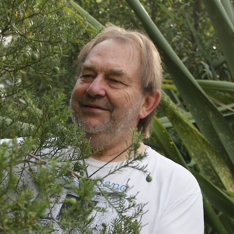
Dr Colin Meurk ONZM · plant ecologist植物生态学家
The species data behind Tika Tipu was compiled by Dr Colin Meurk, a New Zealand plant ecologist whose work on indigenous biodiversity in production and urban landscapes has shaped how native planting is done here. His research spans subantarctic and alpine vegetation, urban ecology and ecological restoration, and he has spent decades arguing that native plants belong in the everyday landscape — on farms, roadsides, city streets and back gardens — not only in reserves.
Tika Tipu 背后的物种数据,由新西兰植物生态学家 Colin Meurk 博士编纂。他关于生产性景观与城市景观中本土生物多样性的研究,深刻影响了新西兰原生植物种植的做法。他的研究涵盖亚南极与高山植被、城市生态学和生态修复;数十年来,他一直主张原生植物属于日常景观——农场、路边、城市街道和后院——而不只属于保护区。
The native database records, for a thousand species, which ecological regions they occur in, which soils and moisture regimes they tolerate, which planting niches suit them, what stage of a restoration they belong to, and what ecosystem services they provide. Tika Tipu is a way of querying that knowledge; the knowledge itself is his.
这个原生植物数据库为一千多个物种记录了:它们分布在哪些生态区,能耐受哪些土壤和水分条件,适合哪些种植生境,属于生态修复的哪个阶段,以及提供哪些生态系统服务。Tika Tipu 只是查询这些知识的一种方式;知识本身是他的。
Accuracy. The database is broad in scope, which means it is necessarily coarse in places. It records what a species can tolerate, which is not always what will thrive on your site. Use it to shortlist, then check with local sources.
关于准确性。这个数据库覆盖面很广,也就必然在某些地方失之粗略。它记录的是某个物种能够耐受什么,而不一定是能在你的样地上长得好。请用它来初筛,然后再向本地资料求证。
Where the data lives数据存放在哪里
The selector is built on two databases, the native one and the exotic one. They share a single column layout — one row per species, one column per attribute, 331 columns, with a plain-English heading on every column and a short field code beneath it — and are merged into one list, each species tagged with which database it came from.
选择器建立在两个数据库之上:原生植物库与外来植物库。两者列结构相同——每行一个物种,每列一个属性,共 331 列,每列都有通俗英文表头,下面附一个简短的字段代码——随后合并为一份清单,每个物种都标明来自哪个数据库。
One species is in both sheets — Schoenoplectus tabernaemontani, the lake clubrush, which is indigenous here and is also sold as a pond plant. The native record wins, so it appears once.
有一个物种同时出现在两个表中——Schoenoplectus tabernaemontani(水葱),它在新西兰是本土种,同时也作为水生观赏植物出售。以原生记录为准,因此它只出现一次。
The soil and frost maps土壤图与霜冻图
Two national datasets sit behind the map click, and neither is Colin’s. The soil order is the top level of the New Zealand Soil Classification, from the Fundamental Soil Layers published by Manaaki Whenua — Landcare Research, gridded at 100 m. The frost count is from NIWA’s downscaled CMIP6 climate projections (CCAM), the historical multi-model median for 1995–2014, on a 5 km grid. Both are read out of the sibling application KiwiMap and reduced to two small images the page can look a single point up in; tools/build_site_lookup.py does that, and documents the reasoning.
地图点击的背后是两套全国数据集,都不是 Colin 的工作。土纲取自新西兰土壤分类的最高一级,来源是 Manaaki Whenua — Landcare Research 发布的 Fundamental Soil Layers,网格 100 米。霜冻日数来自 NIWA 降尺度的 CMIP6 气候情景(CCAM),为 1995–2014 年历史时段的多模式中位数,网格 5 公里。两者都从姊妹应用 KiwiMap 中读出,并简化为两张小图,供页面查询单个点位;这项工作由 tools/build_site_lookup.py 完成,其中也记录了取舍的理由。
The reduction is lossless for soil and deliberately lossy for frost: the soil grid keeps its full 100 m detail, while frost is carried at 500 m because the model underneath it resolves nothing finer than 5 km anyway. Nothing is fetched until you click the map, and then only the one tile your click falls in.
这种简化对土壤是无损的,对霜冻则是有意的有损:土壤网格保留了完整的 100 米细节,霜冻则以 500 米承载——因为它底层的模式本来就分辨不出比 5 公里更细的尺度。在你点击地图之前不会请求任何数据,点击之后也只取你点中的那一块瓦片。
Ninety-five per cent of the country’s land carries a mapped soil order. Another two and a half per cent is town, river bed, estuary, quarry or made ground, and there the app offers the commonest soil order mapped within 5 km and says on screen that it has done so. The remaining two and a half per cent — lakes, permanent ice, and the middle of the largest cities, where the nearest mapped soil is further off than that — gets no answer at all rather than a guess. A click on the Auckland waterfront is 8.5 km from the nearest ground the soil map classifies, so it returns nothing, which is the honest result.
全国 95% 的陆地有已制图的土纲。另有 2.5% 是城镇、河床、河口、采石场或人造地面,在这些地方应用会给出 5 公里范围内制图最普遍的土纲,并在屏幕上注明这一点。剩下的 2.5%——湖泊、永久冰川,以及最大城市的中心区,那里最近的制图土壤比 5 公里还远——则干脆不给答案,而不是猜一个。在奥克兰海滨点击一下,距离土壤图有分类的最近地面有 8.5 公里,所以它什么也不返回,这才是诚实的结果。
The exotic database外来植物数据库
The exotic sheet is not Colin’s work and does not carry the same authority. Scientific and common names, maximum height, planting spacing and the five tolerance ratings are compiled values. Everything else is derived by rule from a curated trait record for each species — growth form, height, those tolerances, warmth requirement, mowing and grazing tolerance, soil reaction preference and documented uses — tested against a climate envelope for each of the 78 ecological regions. Where no published value was available, the field was estimated from the species’ documented ecology and from horticultural and agronomic experience in New Zealand. Every value is a first approximation for screening.
外来植物表不是 Colin 的工作,权威性也不同。其中的学名与俗名、最大株高、栽植株距以及五项耐性评级,是汇编而来的数值。其余内容均由每个物种经整理的性状记录按规则推导而得——生长型、株高、上述各项耐性、需热量、耐刈割与耐放牧性、对土壤酸碱的偏好以及有记载的用途——并与 78 个生态区各自的气候包络逐一比对检验。凡是找不到已发表数值的字段,则依据该物种有记载的生态习性,以及新西兰的园艺与农艺经验来估计。所有数值都只是用于初筛的一级近似。
The productive-land columns behind the vegetable garden, market garden, flower garden, forestry and pasture settings were added on top of both sheets. For an exotic they come from a curated crop classification — a cabbage is a vegetable, perennial ryegrass is a pasture grass, and no column in either workbook said so. For a native they are derived entirely from columns the sheet already held, so no native species has been given a botanical claim it did not already carry.
菜园、商品菜园、花园、林业与牧草地这几个场景背后的生产用地字段,是后来加在两个表之上的。对外来物种,它们来自一套经整理的作物分类——甘蓝是蔬菜,多年生黑麦草是牧草,而两个工作簿原本都没有哪一列写明这一点。对原生物种,这些字段完全由表中已有的列推导而来,因此没有任何原生物种被赋予它原本不具备的植物学论断。
Species on the National Pest Plant Accord, and well-known regional pest plants, are excluded from the exotic sheet, so nothing in it is banned from sale, propagation or distribution in New Zealand. The Accord is amended from time to time — check the current list and your regional pest management plan before planting.
列入 National Pest Plant Accord 的物种,以及各地公认的有害植物,都已从外来植物表中剔除,因此表中没有任何一种在新西兰被禁止销售、繁殖或传播。该协定会不时修订——种植之前,请查阅最新名录以及你所在大区的有害生物管理计划。
Got your species list? Now plant it properly. Choosing the right species is only half the job — survival comes down to fencing, pest control, weed control and technique. Read How to plant, or jump straight to the planting day checklist.
拿到物种清单了?接下来要把它种好。选对物种只完成了一半的工作——能不能活下来,取决于围栏、有害动物防治、除草和栽植技术。请阅读如何种植,或者直接跳到种植当天清单。